


JAVELINA Voting District, Maricopa County, Arizona
About
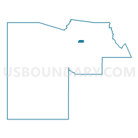
Outline

Summary
| Unique Area Identifier | 524319 |
| Name | JAVELINA Voting District |
| County | Maricopa County |
| State | Arizona |
| Area (square miles) | 10.10 |
| Land Area (square miles) | 10.10 |
| Water Area (square miles) | 0.00 |
| % of Land Area | 99.96 |
| % of Water Area | 0.04 |
| Latitude of the Internal Point | 33.71131240 |
| Longtitude of the Internal Point | -111.97088910 |
Maps


Graphs
Select a template below for downloading or customizing gragh for JAVELINA Voting District, Maricopa County, Arizona


Neighbors
Neighoring Voting District (by Name) Neighboring Voting District on the Map
- AVIANO Voting District, Maricopa County, AZ
- BRONCO Voting District, Maricopa County, AZ
- CAVE BUTTES Voting District, Maricopa County, AZ
- COYOTE BASIN Voting District, Maricopa County, AZ
- DYNAMITE Voting District, Maricopa County, AZ
- LOMA VERDES Voting District, Maricopa County, AZ
- NORTERRA Voting District, Maricopa County, AZ
- PINNACLE WEST Voting District, Maricopa County, AZ
- SIERRA PASS Voting District, Maricopa County, AZ
- TATUM Voting District, Maricopa County, AZ
Top 10 Neighboring County Subdivision (by Population) Neighboring County Subdivision on the Map
Top 10 Neighboring Place (by Population) Neighboring Place on the Map
Top 10 Neighboring Unified School District (by Population) Neighboring Unified School District on the Map
- Paradise Valley Unified District, AZ (239,872)
- Deer Valley Unified District, AZ (239,044)
- Cave Creek Unified District, AZ (56,235)
Top 10 Neighboring State Legislative District Lower Chamber (by Population) Neighboring State Legislative District Lower Chamber on the Map
Top 10 Neighboring State Legislative District Upper Chamber (by Population) Neighboring State Legislative District Upper Chamber on the Map
Top 10 Neighboring 111th Congressional District (by Population) Neighboring 111th Congressional District on the Map
Top 10 Neighboring Census Tract (by Population) Neighboring Census Tract on the Map
- Census Tract 6133, Maricopa County, AZ (7,102)
- Census Tract 6124, Maricopa County, AZ (6,840)
- Census Tract 6150, Maricopa County, AZ (6,630)
- Census Tract 6152, Maricopa County, AZ (5,386)
- Census Tract 2168.40, Maricopa County, AZ (4,594)
- Census Tract 2168.22, Maricopa County, AZ (4,156)
- Census Tract 6151, Maricopa County, AZ (3,383)
- Census Tract 2168.41, Maricopa County, AZ (3,056)
Top 10 Neighboring 5-Digit ZIP Code Tabulation Area (by Population) Neighboring 5-Digit ZIP Code Tabulation Area on the Map
- 85255, AZ (37,270)
- 85331, AZ (26,960)
- 85050, AZ (25,736)
- 85024, AZ (22,898)
- 85266, AZ (11,406)
- 85054, AZ (5,384)